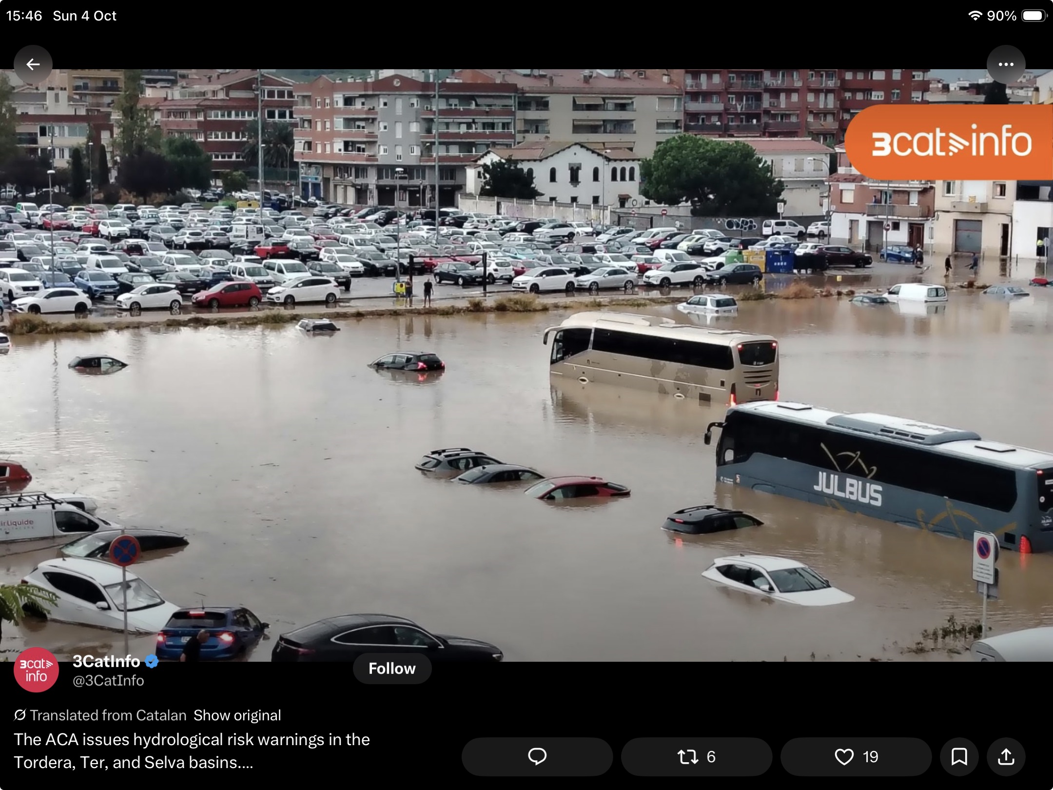

Eastern Spain has spent the past few days under red weather warnings, emergency restrictions and repeated advice to avoid travel. Spain’s meteorological agency warned that parts of Tarragona and Castellón could receive 250 millimetres of rain in twelve hours, with local hourly totals reaching 90 millimetres. Catalonia activated its INUNCAT flood plan and imposed restrictions across twenty districts as the storm moved along the Mediterranean coast.
The immediate lesson is obvious: when the warning arrives, people should act. Do not drive through floodwater, do not enter an underpass and do not treat a red alert as an exaggerated forecast. Flash floods move faster and carry more force than most people expect. But there is a wider policy lesson. A warning can reduce deaths; it cannot enlarge a drain, restore a floodplain or move a vulnerable building out of harm’s way.
Weather first, attribution later
The present episode has a clear meteorological explanation. Cold air higher in the atmosphere combined with abundant moisture from the Mediterranean, creating unstable conditions capable of producing intense and persistent thunderstorms. That explains the weather system. It does not, by itself, quantify the influence of climate change on this particular event.
That distinction matters. It is reasonable to say that warmer air can hold more moisture and that a warmer Mediterranean can provide additional energy and water vapour. It is not yet possible to attach a defensible percentage to this week’s rainfall without a dedicated attribution study. Claims made during the emergency should therefore separate established physical risk from conclusions that still require analysis.
We do, however, have relevant evidence from the catastrophic Valencia flood of October 2024. A peer-reviewed study published in Nature Communications this year compared the event under present-day and pre-industrial conditions. It concluded that human-induced warming intensified the six-hour rainfall rate by 21 per cent, increased the area receiving more than 180 millimetres by 55 per cent and raised the total volume of rain within the Júcar catchment by 19 per cent.
Those results relate to the 2024 event, not automatically to every Spanish storm. They nevertheless show how climate change can amplify an already dangerous Mediterranean weather pattern. The hazard is not newly invented, but the atmosphere in which it operates is changing.
The damage is also a planning decision
Rainfall becomes a disaster through its interaction with place. Roads and paved surfaces accelerate runoff. Development removes space where water could spread safely. Undersized culverts and combined sewers reach capacity. Homes, care facilities and electrical equipment remain at ground level. None of these factors causes the storm, but each influences the damage.
This is why adaptation cannot be reduced to better forecasting. Alerts, phone messages and emergency response are essential, but they are the final layer of protection. Earlier decisions about planning, drainage, building standards, river restoration and maintenance determine how much work the emergency services must do when the rain arrives.
Northern Ireland already has the maps
Northern Ireland’s rainfall regime is different from Spain’s, but the institutional question is familiar. The Climate Change Committee estimates that about 45,000 properties here are at risk from some form of flooding. It also notes that Northern Ireland’s building regulations do not contain specific flood-risk standards, while councils lead spatial planning and the Department for Infrastructure acts as a statutory consultee.
The Department’s Flood Maps already show river, coastal and surface-water risk under present-day and future climate scenarios. The current Flood Risk Management Plan covers 2021–2027 and identifies twelve Areas of Potential Significant Flood Risk. It promotes prevention, protection and preparedness, including defences, maintenance, natural flood management, household resilience and warning systems.
The framework is sensible. The weakness is that a plan can describe every useful action without establishing which will be delivered first, how success will be measured or what happens when development pressure conflicts with future flood risk. The next plan should close that gap.
Turn warnings into investment
Before the next flood-risk cycle begins, the Executive should publish a costed programme for the highest-risk communities. It should state which drainage and defence projects will proceed, where natural flood storage will be restored, how many vulnerable properties will receive resilience measures and which schemes remain unfunded. Progress should be reported annually against dates and outcomes rather than lists of activity.
Planning policy should also adopt a stronger presumption against new development in areas exposed under climate-adjusted maps. Where development is exceptionally permitted, building regulations should require resilient floor levels, protected utilities, safe access and drainage designed for future rainfall rather than yesterday’s average. Existing homes in vulnerable areas will require targeted grants, particularly where residents cannot finance protection themselves.
None of this will prevent extreme rain. It can prevent extreme rain becoming the same emergency in the same places again and again. Spain’s alerts demonstrate the value of acting when danger is hours away. Climate adaptation asks a harder question: what did government do when the danger was still years away? A red warning is necessary. It should never be mistaken for a flood defence.
Sources
- AEMET severe-weather warnings, accessed 4 October 2026.
- Spanish Civil Protection alert, 2 October 2026.
- “Human-induced climate change amplification on storm dynamics in Valencia’s 2024 catastrophic flash flood”, Nature Communications, 2026.
- Climate Change Committee, A Well-Adapted UK, 20 May 2026.
- Department for Infrastructure, Flood Risk Management Plan 2021–2027.
- Department for Infrastructure, Flood Maps (NI).


